|
Proposed
Project Land
|
|
|
|
|
|
When we undertake the use of land for our purposes and to our benefit, we properly take also the burden of responsibility for the land. As stewards, caretakers of the land, the duty to match land use with the character of the land is ours alone. While we can adapt the land with technology and tools to our design, the land itself speaks to us of what is best. Flat lands, with rich, loamy soils are best used to grow crops and produce food. Different land types, with different characteristics of slope, soil composition or ability to retain moisture cannot perform that function as well. They are better suited to other uses. The land chosen for this project has characteristics that indicate housing as a best use. It is close to other lands used for this purpose. Infrastructure may need only to be extended rather than created anew. It is of a size suitable for the need and it is close to the services needed by the proposed users. It's also part of Cal Poly, where the users of the land will work, its use then creating a community contiguous to the campus proper, rather than another distant community from which workers must commute. History
Of The Land Adjacent
Zoning |

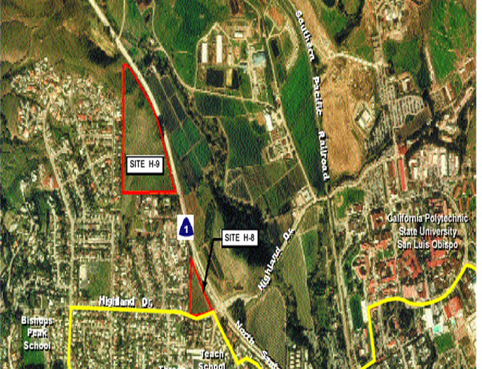
 An
aerial view of the project area (Cal Poly Housing Corp.)