cal poly land

overview
this project
maps
archives
what's new

places
agriculture lands
poly canyon
stenner canyon
western ranches
adjoining lands

topics

soils & water
flora and fauna
natural resources
agriculture
technology
history
the arts

stewardship

History Of The Land

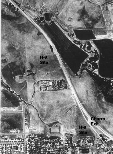
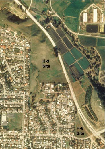
The land involved in this project came to Cal Poly in two acquisitions, eleven years apart. The earlier of the two, 628 acres known at the Rodney V. Johnson tract, was purchased on January 28, 1918, for $50,910. This tract encompassed much of the land north and immediately west of the campus core, and was bought as watershed to ensure an adequate water supply for Cal Poly . Highway 1 bisects the property, isolating a small triangular parcel, about 5.86 acres, that is proposed to be used for the development of the H8 site. This land is currently vacant and unused.

The later acquisition, 177 acres west of and adjoining the Johnson tract, was purchased from Matteo Fiscalini on June 1, 1929. The purchase price, as reported in the 1985 work by John V. Stechman, was the “sum of $10.00 cash in hand”. This property too was split by Highway 1, creating another triangular parcel, about 24 acres, separated from the main Cal Poly campus. This land is the proposed location of the H9 site. It is currently used for grazing of livestock. The California Department of Forestry maintains a fire station on a small leased parcel along the south edge.

Images of the land

These two images, taken forty-three years apart, show the changes that have occurred around these two parcels. Note the Chorro Street exit from southbound Highway 1 in the 1957 photograph. Looking at the 2000 photograph, it's easy to see how residential neighborhoods have developed on the west and south of the property. Of importance in the context of compatible land use, note the apartment complex immediately north of the proposed H-8 site.

1957 Aerial Photo

2000 Aerial Photo

Return To Main Page - Return To Proposed Project Land Close Window