|
Cheda Hike |
|
|
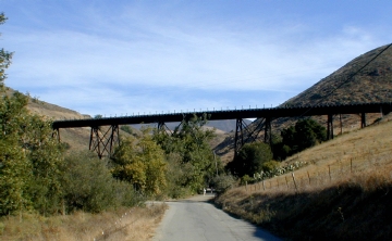
Stenner Creek trestle |
|
|
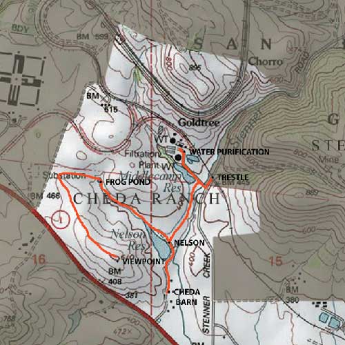
The Cheda Hike starts at the Stenner railroad trestle, turn left on the last paved road before the trestle. As you proceed down the path, Middlecamp reservoir will be on your right. As you pass by Middlecamp reservoir, the water treatment facility for the city of San Luis Obispo and Cal Poly is directly behind. Head forward to the next reservoir, Nelson reservoir and proceed left to Cheda Ranch. Once you pass Nelson reservoir you will see hills of sheep and the Cal Poly sheep unit. You will then follow the trail further to a point that allows you to see Stenner Creek with the Cheda barn to your left. The Cheda barn contains a combination of early 1900 architecture and modern farm equipment. This is the end of the Cheda Ranch hike, to return follow the trail back. Below is a map of the Cheda Ranch Hike
Directions
to Cheda Ranch hike.
To return to the Hiking Home Page click here. Hiking To return to the Recreation home page click here. Recreation
|

 .
.