|
|
The
History and Use of Cal Poly Land
Map
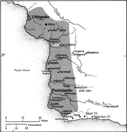
of Chumash Territory
|
|
 From
Handbook of North American Indians, Volume 8
|
| The
Obispeņo Chumash occupied the territory from the coast, inland to
the Santa Lucia mountains in the east, Point Estero in the north,
and to a shared boundary with the Purisimeņo Chumash at approximately
Pismo Beach in the south. They mostly occupied the coastal areas
in the winter. In late spring they migrated inland, following seasonal
migration routes along Chorro and San Luis Obispo Creeks.
|
|